Programme setup and preparation of initial data for autonomous work in IPC SE "ZOV maps", peculiarities of fast loading
To work offline (without internet) "ZOV map", you need to download the posted on the channel https://t.me/zovmaps, @zovmaps data: topographic map and space images stitching tie sets (TS), address base, relief matrix, programme update, etc. (see Fig. 1). (see Fig. 1).
Recommendation: Data loading is performed using Yandex-disk links (to speed up loading by 5-7 times it is recommended to use the download wizard, e.g. for the desktop version "Download Master" or "FDM" for mobile).
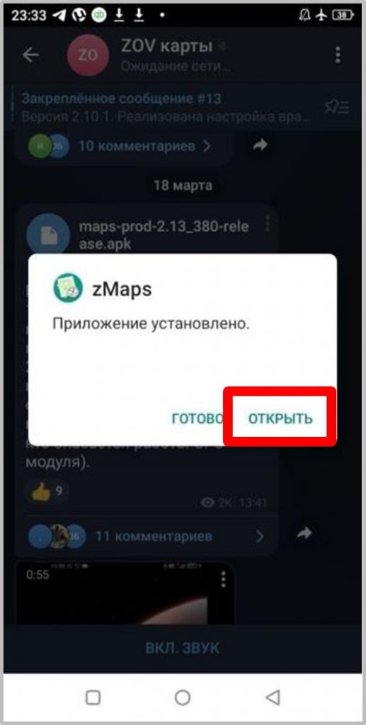
Install the latest mobile version of ZOV Maps by downloading a file with *.apk extension from the channel, e.g. version: maps-prod- 2.13_380-release.apk (fig. 1). Next, the obtained licence key (1.7-1.8) is loaded and the program is configured for further work.
Reference: Obtaining a licence key is mandatory for the software to work, this procedure allows you to ensure full binding of the installed software only to your device, which, according to the authors, is one of the elements of preventing information leakage and uncontrolled distribution of the software.
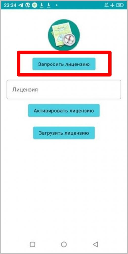
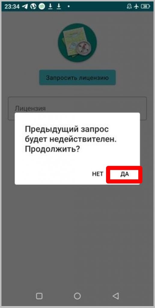
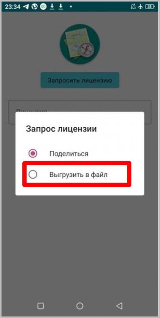
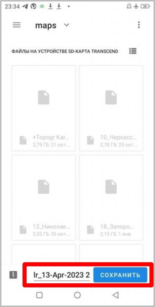
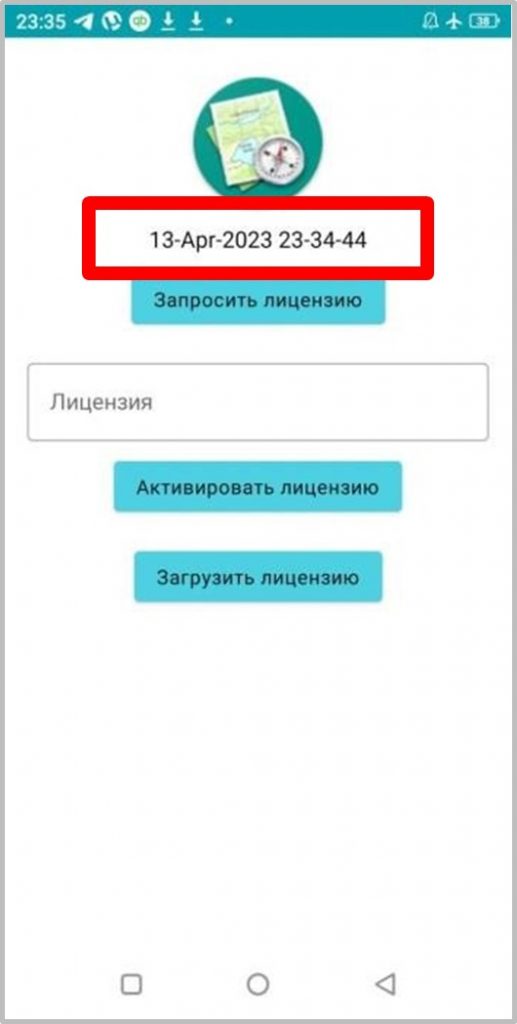
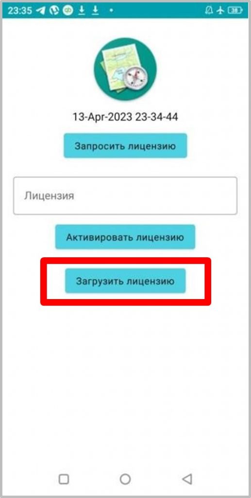
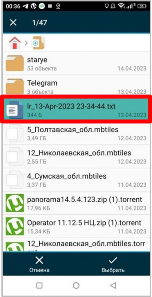
1) Sequence of programme installation Installation of the program (Fig. 1.1) is carried out in the following sequence: requesting a licence (Fig. 1.2-1.6), sending a request file (for example: lr_03-Apr-2023 13-55-55.zip) to the Telegram channel (Fig. 1.5): @zovmap → licence issuance (not to be confused with @zovmaps! → main branch - licences are not issued here)Further you will be sent by the channel administrators a text file of the licence, which must be downloaded (Fig. 1.7-1.9) "Download Licence".
After launching the programme, it is necessary to make a number of settings and data download for offline operation (in the mode of map download from the Internet the programme works by default, see Fig. 1.9).
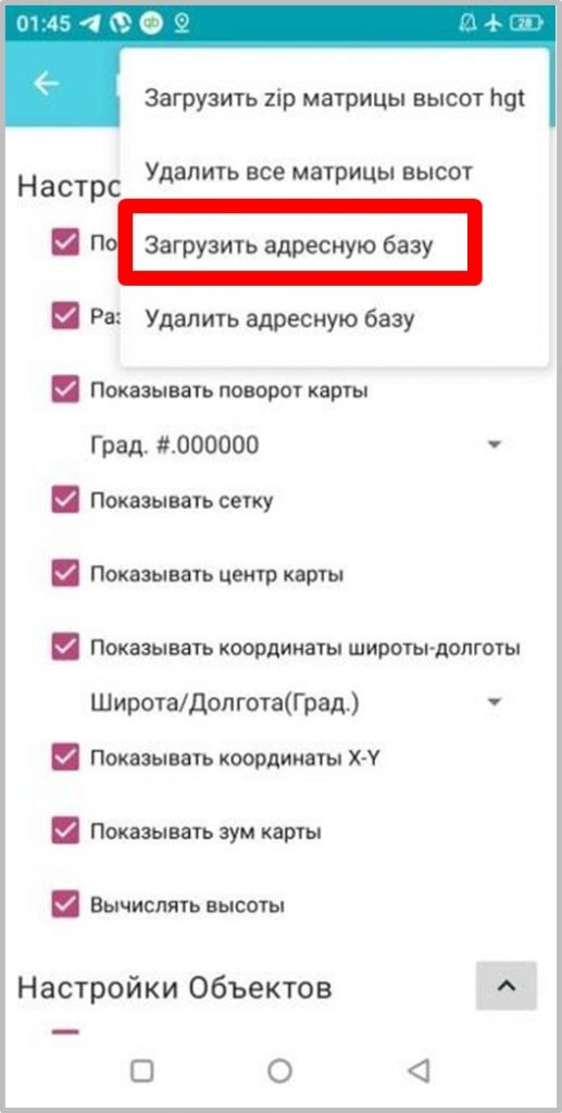
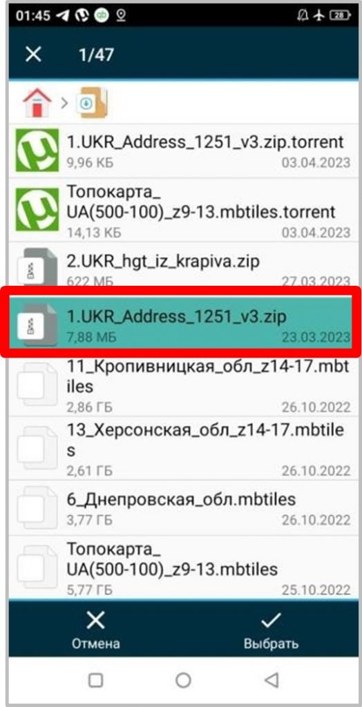
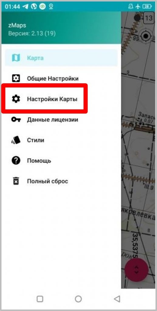
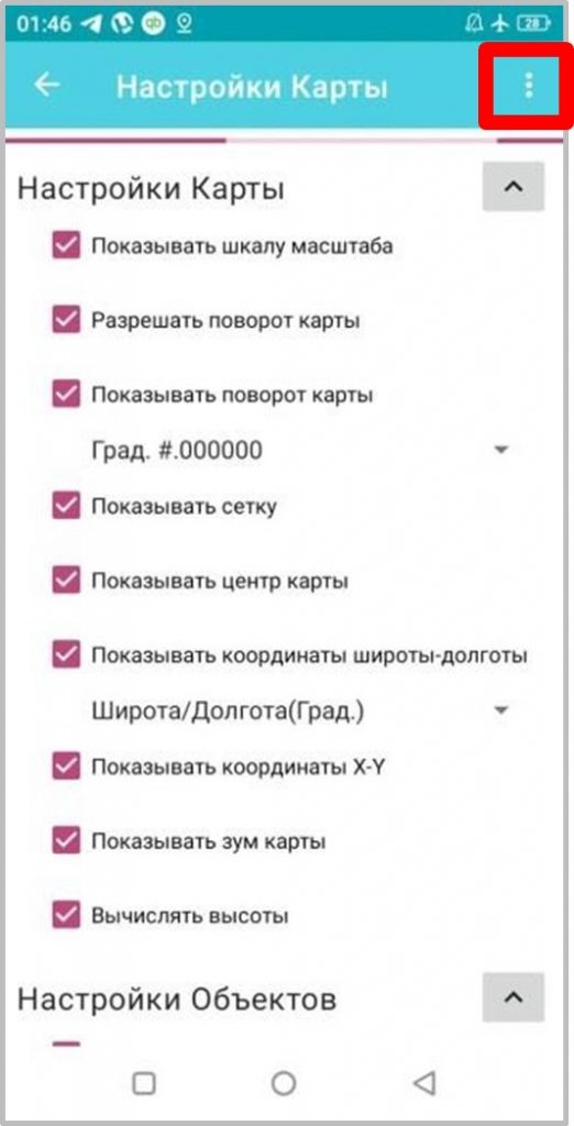
2) Downloading an adapted address base, e.g: 1.UKR_Adress_1251_v3.zipThe procedure is as follows: enter the programme setting mode by sliding your finger on the smartphone/tablet screen from left to right, during which the "curtain" of the programme setting menu is displayed/removed (Fig. 2.1). Next, the following actions are performed: "Map settings" - fig. 2.1, "..." - Fig. 2.2, "Load address base" - Fig. 2.3, then specify the location of the file of the actual address base, for example: 1.UKR_Adress_1251_v3.zip, as shown in Fig. 2.4.


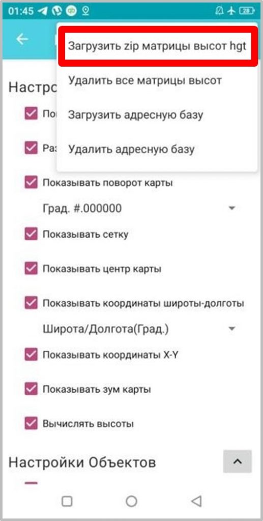
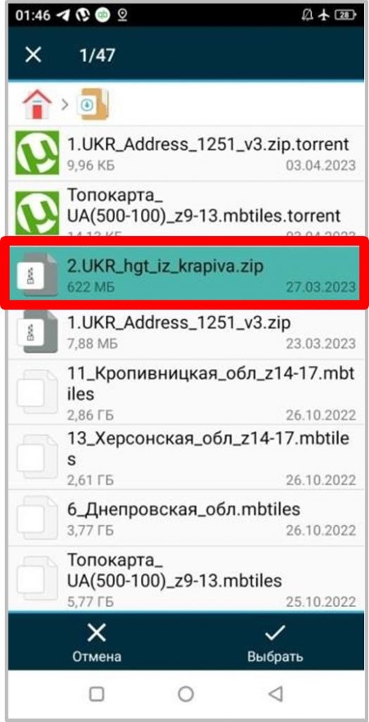
3) Loading an adapted elevation matrix, e.g.: 2.UKR_hgt_iz_krapiva.zipThe procedure is as follows: enter the programme setting mode by sliding your finger on the smartphone/tablet screen from left to right, during which the "curtain" of the programme setting menu is displayed/removed (Fig. 3.1). Next, the following actions are performed: "Map settings" - fig. 3.1, "..." - Fig. 3.2, "Download zip matrix of heights hgt" - fig. 3.3, then the location of the actual elevation matrix file is specified, e.g.: 2.UKR_hgt_iz_krapiva.zip, as shown in Fig. 3.4.
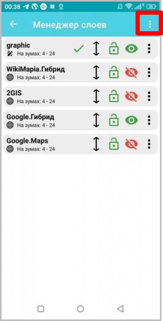
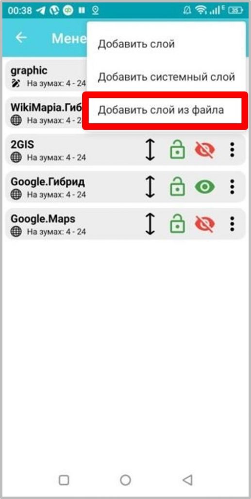
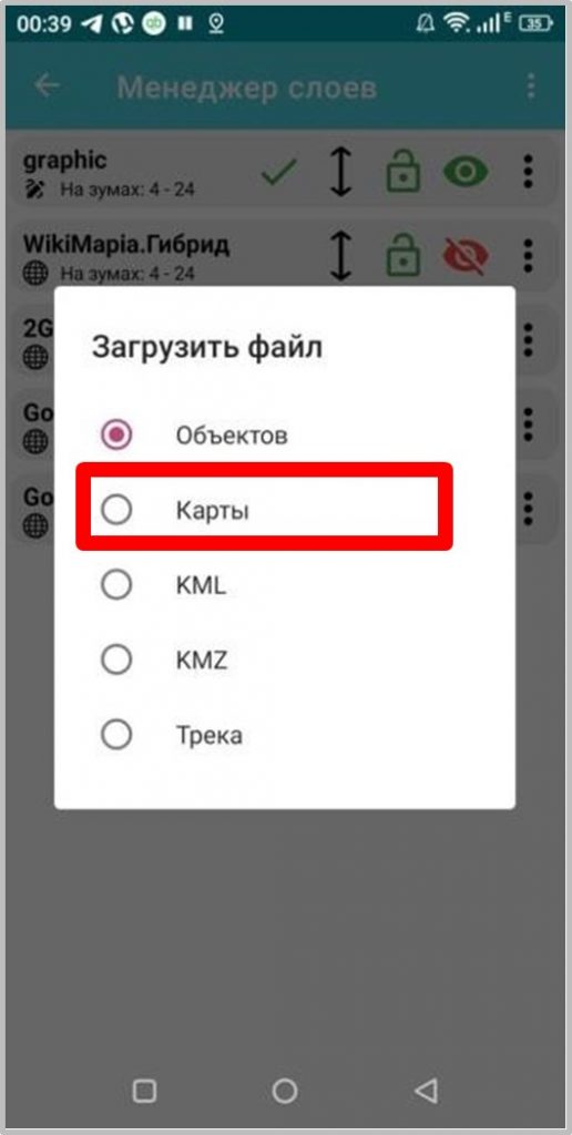
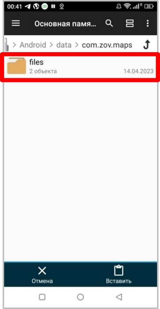
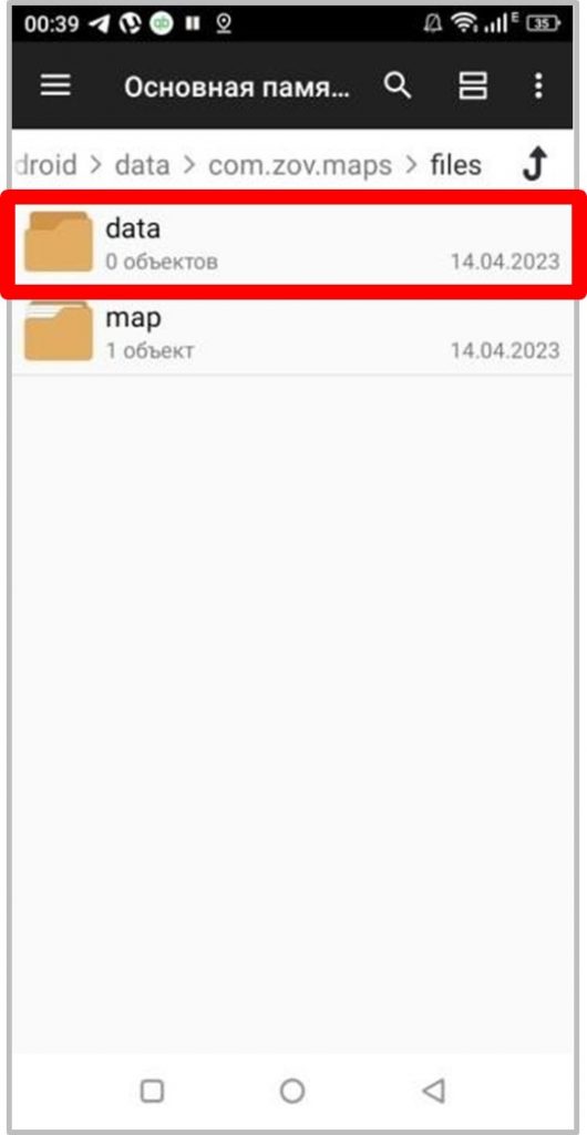
4) For correct display of downloaded tile sets (TS) in the mobile software complex of geoinformation support of IPC SE "ZOV Maps" it is necessary to follow the following recommendations when downloading and preparing them for work: to prevent duplication of downloaded files it is necessary to create a catalogue of temporary file downloading (i.e. a catalogue where it is necessary to place all TS, subject to accelerated subsequent downloading). To do this you need to perform the following actions: start the programme, enter the "Layers" submenu (Fig. 4.1), "..." (Fig. 4.2), "Add layer from file" (Fig. 4.3), select "Maps" in the "Load file" tab (Fig. 4.4), after which the programme will create a temporary directory { "data". in the root folder in the internal memory of the device at the following address: "...>Android>data>com.zov.maps>files>....."(Fig. 4.5- 4.6), after performing the above actions, the temporary catalogue for accelerated loading of the entire array of TNs is ready.
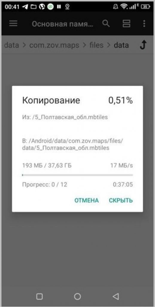
Next, using any file manager of the Android system, for example: "File Manager +", the necessary array of prepared TNs is copied to the newly created temporary directory "data" (Fig. 5).
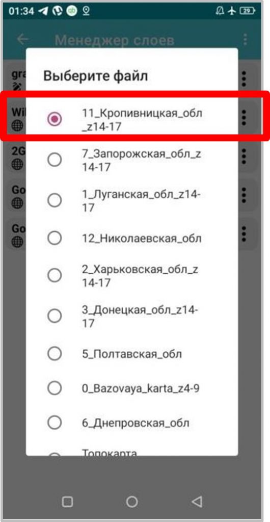
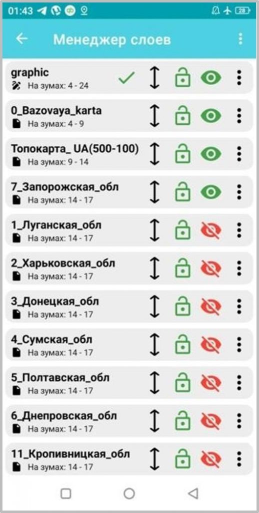
Then, using the submenu "Layers" (Fig. 4.1), "...", "..." (Fig. 4.2), "Add layer from file" (Fig. 4.3), in the "Load file" tab select "Maps" (Fig. 4.4), the necessary TNs are added one by one to the work area (Fig. 6.1), in this case, for autonomous operation of the programme, all layers should be disabled, except for the used ones, as shown in Fig. 6.2 - where the duty layer for mapping the operational and tactical situation, which is the system - "graphic" (Fig. 4.4). 6.2 - where the on-duty layer for plotting the operational-tactical situation, which is the system - "graphic" and the graphic layers created by the user (as well as track data layers) should always be at the top of the list (in this case, always on the active/editable layer is put a "green tick" see Fig. 6.2). Fig. 6.2); further down the list is the base map, for example: 0_Bazovaya_karta with zoom 4-9, topo base, for example: Topomap_UA(500-100) with zoom 9-14, satellite stitching area of larger scale, for example: 7.Zaporizhzhya_obl with zoom 14-17, below, if necessary, even more detailed area of tasks with zoom 17-24 is placed.
The recommended sequence of VT placement is shown in Fig. 6.2.
Moving layers is performed by pinching the required layer with a finger and holding it down while moving it and then setting it to the required position in the list of layers (Fig. 6.2).
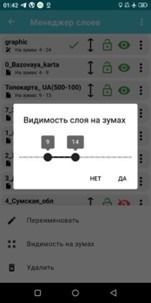
The zoom is set by calling the "..." submenu in the active window "Layers", "Visibility on zooms" (Fig. 6.3), then the zoom required for display is set (Fig. 6.4).
For the purpose of qualitative development and fast promotion of Our project, the "ZOV Maps" team asks You to submit explanations, instructions and recommendations on examples of the programme use, which will be analysed and added to the main manual.
In qualitative feedback, please use the group at "Telegram on the channel at https://t.me/zovmaps in the programme discussion or in the @zovmap thread.
In addition, please, to speed up the development of the project, post your instructions and examples of "live" work of the programme (both successful and unsuccessful), which will be included in the main manual and will form an arsenal of examples of its use or will serve as a basis for quick correction of errors in the work of the programme.